Japanese / English
Computer Aided Design by using Frequency Analysis of Unorganized Point Cloud
Okane Shinji
Image Processing Laboratory
Graduate School of Information Science
Nara Institute of Science and Technology
master thesis(Japanese only...)(pdf)
Iwait2003(pdf)
keyword:point rendering, point sampled geometry, frequency analysis, cad, laser range scanner
This paper proposes a new filtering method to achieve real-time computer
graphics of precise 3D shapes. By recent 3D scanning systems, it
becomes possible to measure 3D shape of objects with high
precision. Normally these scanners sample 3D positions of points
(point clouds) on the surface of objects. It is necessary to build polygon
model before synthesizing surface-rendered computer graphics. Increase
of measurement data by progress of recent 3D scanning systems,
however, makes cost of creation of polygon model higher. Thus
non-surface rendering including point rendering techniques are focused
on. To achieve high-quality point rendering of objects scanned by
such 3D scanners, the proposed system must perform some kind of filtering on obtained
data since point data obtained by 3D scanner is often irregularly
formed and also has non-uniform density. The proposed system have achieved one of such
filtering by applying resampling and frequency analysis to point
clouds.
we propose a new filtering method for applying to
measurement data to remove noise and deform object form.
First, the plane which can do one-to-one projection for obtained point
clouds is created. Next, a grid is created on a plane. Each grid
holds distance of plane and each point, and fourier transform is
applied to the grid value. Finally, a value is operated in a
frequency domain using filter and it returns by reverse conversion.
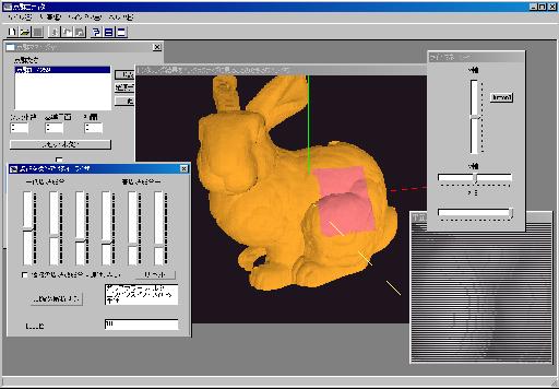
This is screenshot of system.
The user can operate point clouds intractivelly.
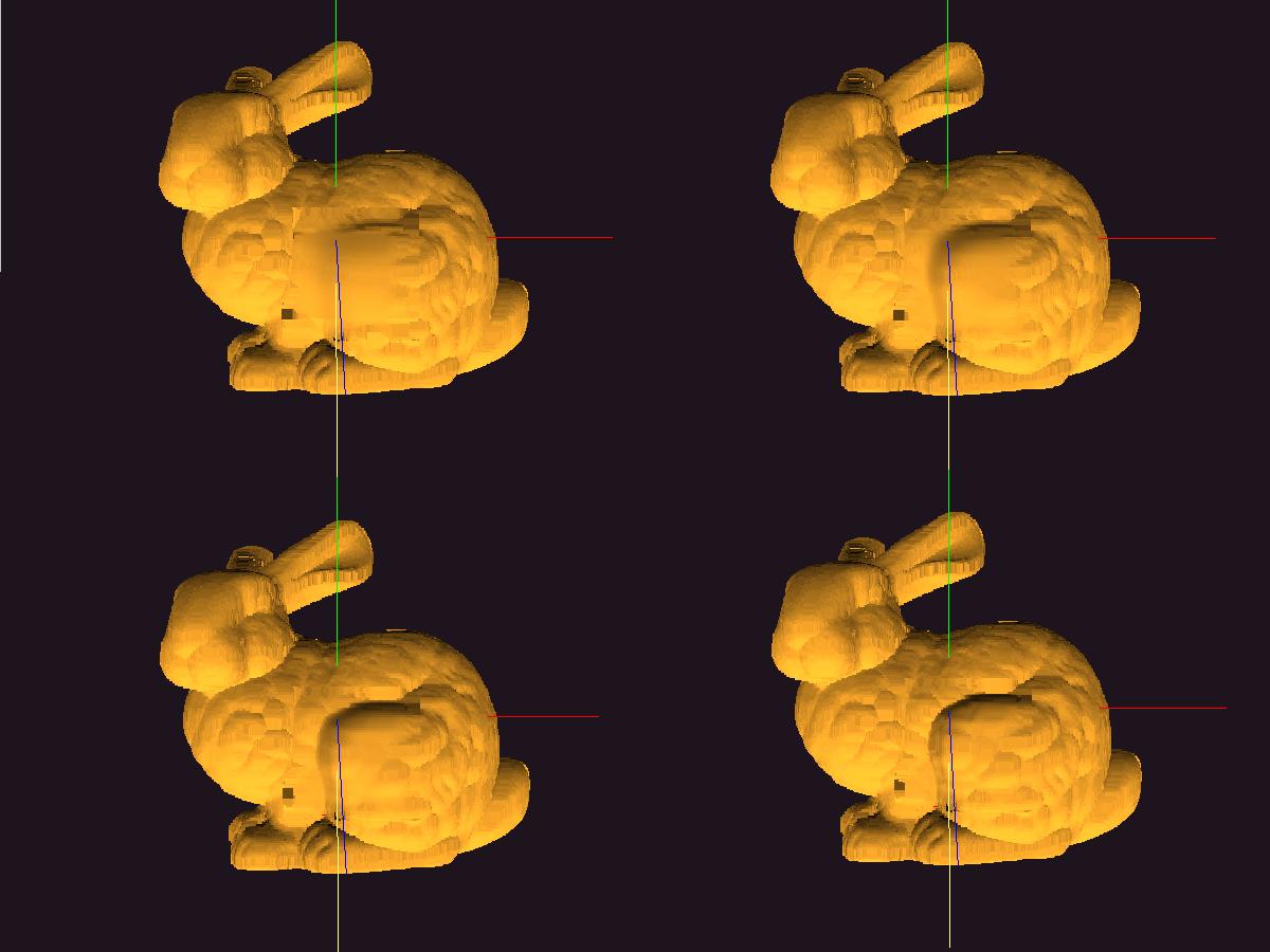
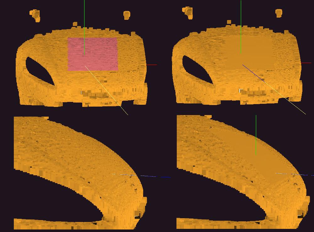
smoothing
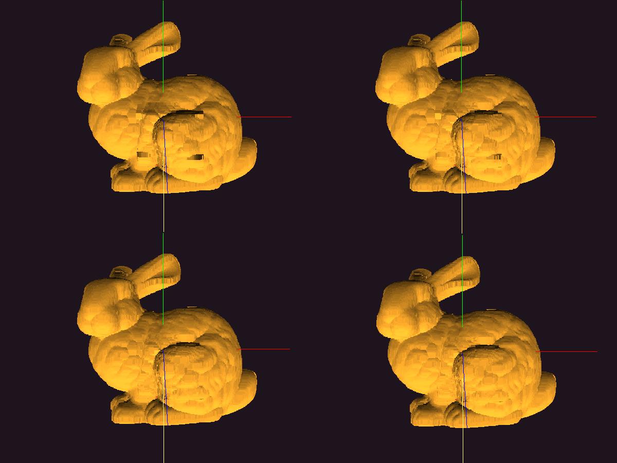
enhancement
applying to indstrial design
We have shown an approach of modifying shape presented by point cloud data,
which lacks topological information. This approach includes the following
steps.
1.Input point clouds data is projected on 2D plane, and
position information was transformed to height information for the plane.
2.Height information was transformed to frequency domain, operating information on frequency domain,
and it returns to the space domain again.
We have achieved to deform shape given only by point cloud smoothly
while keeping fundamental form of the given shape.
We also have achieved an enhancement of shape given only by point cloud.
ホームへ